1. General Standards 📐
All map layouts must include the following elements to maintain brand consistency and ensure proper geographic context:
- NGI graticule (grid lines without labels)
- Attribution (NGI & Kartoza/SAGTA)
- Magnetic Declination (display for the Topographic map layouts except South African Thematic, World Thematic, Orthophoto, & Hybrid)
- North arrow
- Logos (SAGTA + relevant partners)
- Title (map name and extents)
- Legend (symbols, colours, and layer descriptions)
- Intersecting sheets list (which adjacent map sheets overlap the current view; omit for South African Thematic & World Thematic)
Page layouts available:
- A3: Landscape & Portrait
- A4: Landscape & Portrait
Printable formats supported:
- PDF · PNG · JPEG · SVG
2. Map Layout Access 🔐
- Authentication: Required (SAGTA members only)
- Print maps: Access to all layouts
- Web functionality: Toolsets enabled for all layouts
Tip: Log in with your SAGTA membership credentials to unlock the features and printing capabilities.
3. Print & Downloadable Maps 🖨️
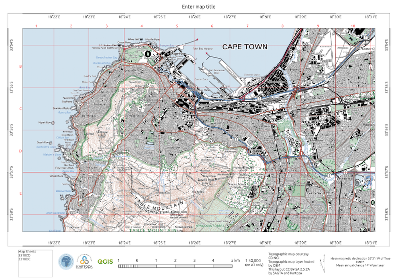
3.1 Topographic Map 🏔️
Layers Included:
- 1 : 50 000 topographic data (OSM or NGI servers; covers South Africa & Namibia)
- Sheet indexes: 1: 50 000 & 1: 10 000 for South Africa & Namibia
Available Scales: 1: 25 000 · 1: 50 000 · 1:100 000 · 1: 150 000
Template Features:
- Standard template (per General Standards)
- Index grid showing sheet boundaries
Interactive/Web Tools:
Protractor, Elevation Profile, Print, Annotation, Measure, Geolocation, Sheet Locator
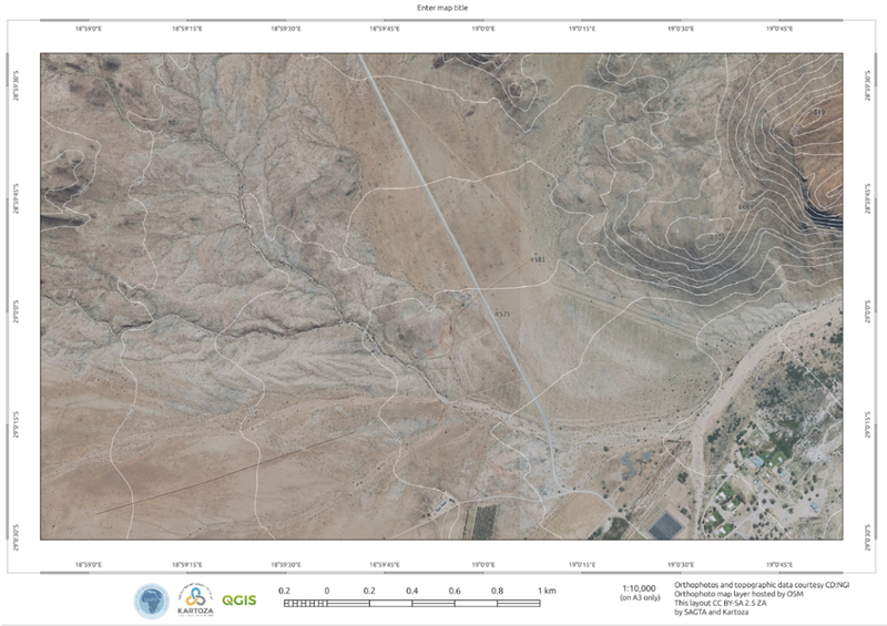
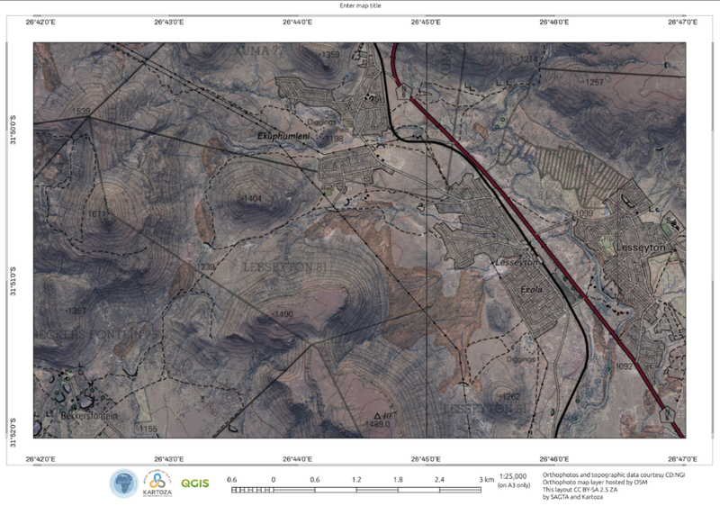
3.2 Orthophoto Map 🌄
Layers Included:
- NGI aerial imagery (South Africa only)
- Contours: 5 m where available; fallback to 20 m in uncovered areas
- Spot heights & trig beacons
- Sheet indexes: 1: 50 000 & 1: 10 000
Available Scales: 1: 5 000 · 1: 10 000 · 1: 25 000
Interactive/Web Tools:
Protractor, Elevation Profile, Print, Annotation, Measure, Geolocation, Sheet Locator
3.3 Hybrid Map 🏞️
Layers Included:
- 1: 50 000 topographic layer (South Africa only)
- NGI aerial imagery (South Africa only)
- NGI 50 K rivers
- DWA dams (500 K)
- Sheet indexes: 1: 50 000 & 1: 10 000
Available Scales: 1: 10 000 · 1: 25 000 · 1: 50 000
Interactive/Web Tools:
Protractor, Elevation Profile, Print, Annotation, Measure, Geolocation, Sheet Locator
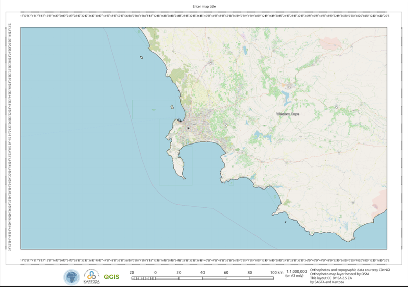
3.4 South African Thematic Map 🏙️
Layers Included:
- Cities & towns · Airports · Seaports
- Population (2025) · Active mines & processing plants (2024)
- Parallels/meridians · Provincial boundaries
- Major roads · Dams & rivers · Drainage basins
- Agricultural & forestry regions · Population density (2025)
- Mean annual precipitation zones
- Monthly average rainfall & temperature (Jan–Dec)
- Vegetation (2018) · Geology · Hypsometric units · DEM
- Global climatic regions (1991–2020) · Ocean surface temperature
Base Layers: OpenStreetMap & IGN orthophoto
Available Scales: 1: 7 500 000 · 1: 6 500 000 · 1: 5 000 000 · 1: 1 000 000 · 1: 500 000
Interactive/Web Tools:
Print, Elevation Profile, Protractor
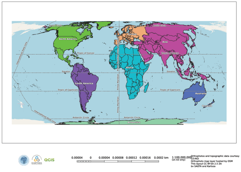
3.5 World Thematic Layouts 🌍
Layers Included:
- Cities · Population (2025)
- Parallels/meridians · Hemispheres · Time zones · Country boundaries
- Topography: glaciers, playas, marine features
- Major ocean currents · Population density (GPW 2020)
- Global climatic regions (1991–2020)
- Mean annual precipitation · Vegetation · Surface temperatures
- Continents · Tectonic plates
Base Layers: OpenStreetMap & IGN orthophoto
Available Scales: 1: 100 000 000 · 1: 50 000 000 · 1: 25 000 000 · 1: 10 000 000 · 1: 5 000 000
Interactive/Web Tools:
Print, Elevation Profile, Protractor
4. Visual Examples 📸
SAGTA topographic map layouts
SAGTA orthophoto map layouts
SAGTA hybrid map layouts
SAGTA World Thematic Layouts
SAGTA South Africa Thematic Layouts